Siu Hong station
This article needs additional citations for verification. (January 2017) |
Siu Hong 兆康 | ||||||||||||||||||||||||||||||||||||||||||||||||||||||||||||||||||||||||||||||||||||
|---|---|---|---|---|---|---|---|---|---|---|---|---|---|---|---|---|---|---|---|---|---|---|---|---|---|---|---|---|---|---|---|---|---|---|---|---|---|---|---|---|---|---|---|---|---|---|---|---|---|---|---|---|---|---|---|---|---|---|---|---|---|---|---|---|---|---|---|---|---|---|---|---|---|---|---|---|---|---|---|---|---|---|---|---|
 Station concourse | ||||||||||||||||||||||||||||||||||||||||||||||||||||||||||||||||||||||||||||||||||||
| Chinese name | ||||||||||||||||||||||||||||||||||||||||||||||||||||||||||||||||||||||||||||||||||||
| Chinese | 兆康 | |||||||||||||||||||||||||||||||||||||||||||||||||||||||||||||||||||||||||||||||||||
| Cantonese Yale | Siuhhōng | |||||||||||||||||||||||||||||||||||||||||||||||||||||||||||||||||||||||||||||||||||
| Literal meaning | Sign or trillion — 兆; Peaceful and happy - 康 | |||||||||||||||||||||||||||||||||||||||||||||||||||||||||||||||||||||||||||||||||||
| ||||||||||||||||||||||||||||||||||||||||||||||||||||||||||||||||||||||||||||||||||||
| General information | ||||||||||||||||||||||||||||||||||||||||||||||||||||||||||||||||||||||||||||||||||||
| Location | Tuen Mun, New Territories Hong Kong | |||||||||||||||||||||||||||||||||||||||||||||||||||||||||||||||||||||||||||||||||||
| Coordinates | 22°24′43″N 113°58′43″E / 22.412°N 113.9786°E | |||||||||||||||||||||||||||||||||||||||||||||||||||||||||||||||||||||||||||||||||||
| Owned by | KCR Corporation | |||||||||||||||||||||||||||||||||||||||||||||||||||||||||||||||||||||||||||||||||||
| Operated by | MTR Corporation | |||||||||||||||||||||||||||||||||||||||||||||||||||||||||||||||||||||||||||||||||||
| Line(s) | Tuen Ma line | |||||||||||||||||||||||||||||||||||||||||||||||||||||||||||||||||||||||||||||||||||
| Platforms | 2 (1 island platform) | |||||||||||||||||||||||||||||||||||||||||||||||||||||||||||||||||||||||||||||||||||
| Tracks | 2 | |||||||||||||||||||||||||||||||||||||||||||||||||||||||||||||||||||||||||||||||||||
| Connections |
| |||||||||||||||||||||||||||||||||||||||||||||||||||||||||||||||||||||||||||||||||||
| Construction | ||||||||||||||||||||||||||||||||||||||||||||||||||||||||||||||||||||||||||||||||||||
| Structure type | Elevated | |||||||||||||||||||||||||||||||||||||||||||||||||||||||||||||||||||||||||||||||||||
| Platform levels | 1 | |||||||||||||||||||||||||||||||||||||||||||||||||||||||||||||||||||||||||||||||||||
| Accessible | Yes | |||||||||||||||||||||||||||||||||||||||||||||||||||||||||||||||||||||||||||||||||||
| Architect | RMJM | |||||||||||||||||||||||||||||||||||||||||||||||||||||||||||||||||||||||||||||||||||
| Other information | ||||||||||||||||||||||||||||||||||||||||||||||||||||||||||||||||||||||||||||||||||||
| Station code | SIH | |||||||||||||||||||||||||||||||||||||||||||||||||||||||||||||||||||||||||||||||||||
| History | ||||||||||||||||||||||||||||||||||||||||||||||||||||||||||||||||||||||||||||||||||||
| Opened | 20 December 2003 | |||||||||||||||||||||||||||||||||||||||||||||||||||||||||||||||||||||||||||||||||||
| Electrified | 25 kV 50 Hz AC | |||||||||||||||||||||||||||||||||||||||||||||||||||||||||||||||||||||||||||||||||||
| Services | ||||||||||||||||||||||||||||||||||||||||||||||||||||||||||||||||||||||||||||||||||||
| ||||||||||||||||||||||||||||||||||||||||||||||||||||||||||||||||||||||||||||||||||||
| ||||||||||||||||||||||||||||||||||||||||||||||||||||||||||||||||||||||||||||||||||||
| ||||||||||||||||||||||||||||||||||||||||||||||||||||||||||||||||||||||||||||||||||||
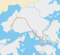
Siu Hong (Chinese: 兆康) is an MTR station located beside Siu Hong Court, Tuen Mun, New Territories, Hong Kong. It is built on the Tuen Mun Nullah immediately east of Siu Hong Court. The station is on the Tuen Ma line between Tin Shui Wai and Tuen Mun stations. Elevated public transport interchanges are provided at both the south and north ends of the station. Two access ramps link the public transport interchanges to Castle Peak Road and Tsing Lun Road for access to feeder services such as buses, minibuses, and taxis.
History
[edit]Construction started in July 1999 with the award of civil contract CC-212 for the West Rail line station to HK ACE JV at a contract sum of HK$1,386 million. The topping-out was marked on 26 February 2002 by KCR chairman Michael Tien and transport legislator Miriam Lau.[1] It was opened to the public on 20 December 2003 with the commencement of West Rail service.
The elevated station is located above the Tuen Mun Nullah. To support the station, 352 columns were built in the river bed, impacting the water flow. As a result, the river was widened by about 17 metres along the length of the station to maintain its drainage capacity.[1]
On 27 June 2021, the West Rail line officially merged with the Ma On Shan line (which was already extended into the Tuen Ma line Phase 1 at the time) in East Kowloon to form the new Tuen Ma line, as part of the Sha Tin to Central Link project. Hence, Siu Hong was included in the project and is now an intermediate station on the Tuen Ma line.
Station layout
[edit]| R | Exits | Exits, public transport interchanges | ||||
| C | Concourse | Exits, customer services, toilets, vending machines, ATMs | ||||
| P Platforms |
Platform 2 | Tuen Ma line towards Wu Kai Sha (Tin Shui Wai) → | ||||
| Island platform, doors will open on the right | ||||||
| Platform 1 | ← Tuen Ma line towards Tuen Mun (Terminus) | |||||
| G | Light Rail stop | Exits, Light Rail Siu Hong stop | ||||
Platforms 1 and 2 share the same island platform.[2]
The first train to Tuen Mun departs at 6:26 a.m., while the last train departs at 12:40 a.m. the day after. The first train to Hung Hom departs at 5:47 a.m., while the last train departs at 12:17 a.m. the day after.
Entrances/exits
[edit]- A: Brilliant Garden[3]
- B1: Light Rail Platform 2[3]
- B2: Light Rail Platform 2[3]
- C1: Light Rail Platforms 1 and 5[3]
- C2: Light Rail Platform 6[3]
- C3: Light Rail Platforms 1 and 5
 [3]
[3] - D: Lost Property & Travel Scheme Office
 [3]
[3] - E: San Hing Tsuen[3]
- F: Lingnan University[3]
References
[edit]- ^ a b "KCR West Rail Siu Hong Station topped out". Kowloon–Canton Railway Corporation. 26 February 2002.
- ^ "Siu Hong Station layout" (PDF). MTR Corporation. Retrieved 30 October 2016.
- ^ a b c d e f g h i "Siu Hong Station street map" (PDF). MTR Corporation. Retrieved 30 October 2016.

